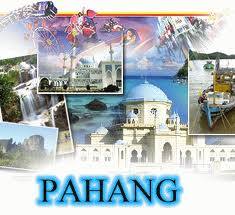

Pahang is the largest state in Peninsular Malaysia and undoubtedly one of the top eco-destinations. Kuantan is its capital city, located along the East Coast.
Nearly two-thirds of Pahang’s 35,000 sq. km land area is covered in dense tropical rainforest, making it a repository for Malaysia’s natural treasures.
Almost all of the highland retreats, some beautiful islands and beaches are found in Pahang.
Pahang’s name is believed to be derived from the ‘mahang’ tree according to a Malay legend. Other sources attribute it to traders from China who called it ‘Pang-Hang’, which slowly became Pahang in spelling and pronunciation.
Pahang was ruled by the Srivijayan Empire in ancient times until its collapse in 1000. Pahang was then conquered by the Siamese and then Malacca in 1400.
After the downfall of Malacca, it became a central part of the territorial conflict between Acheh, Johor, the Portuguese, and the Dutch.
Finally, in 1888, Pahang was conquered by the British before receiving independence with the rest of Malaysia in 1957.
With a population of 1 million, Pahang is peaceful and unspoilt. As a bulwark of natural conservation, visitors who truly love nature will adore the state for all its natural goodness.


